
One of my favorite hikes in San Luis Obispo county is Valencia Peak. I’m a sucker for ocean view hikes, and if you are too then this is exactly what you’re looking for.

Montana de Oro State Park is about 25 minutes outside of San Luis Obispo and admission is free, which is perfect for when you’re looking for a quick hike with a view worth the climb. Take Los Osos Valley road until it comes to Pecho Valley Road and take this into the park. See the bottom of the post for exact trailhead coordinates!
There’s parking right in front of the trailhead, but beware that I have seen more than one minivan or sedan bottom out in attempt to park on this dusty and bumpy lot (but luckily Conner’s truck was up to the job).

The trail is about 2.2 miles up to the 1,347 feet peak, (about 4.5 miles roundtrip) meaning that gets very steep in some parts and also has sheer cliffside drop-offs, so watch your step. Usually when you hike you start a little ways up the hill (think Bishop’s Peak if you’re from SLO) but this hike it literally starts at sea level by the sea, so you’re hiking the full 1,000+ feet!

In the Spring, this route has a plethora of gorgeous blooming wildflowers, but in the Summer we at least get to see what remains of them… Still pretty. About 2 tenths of a mile in, you can look down to see Islay Creek campground which fun fact: I camped there in January once and it was quite cold- so if you’re gonna camp there maybe do it in a warmer month.
A little ways up you’ll come to a fork in the path on the right. Follow the signage and take the trail going straighter upwards. It says it’s only one more mile to the peak but keep in mind that it’s a steep one!


Be respectful of the parts of the trail which are closed for restoration, or roped off to restrict access. The reason they’re closed is either for your own safety, or for the preservation of the mountain itself so that everyone can continue to enjoy it in the future as well.

The beginning of the trail is extremely dusty while the following parts are covered in jagged rocks. These rocks can become loose and get dislodged so be careful to watch your step when climbing. The higher you get up the mountain the more common and steeper the rocks become.

As you’re heading up, if you’re facing west toward the ocean, off to the north-west is Morro bay and Morro rock, and South-east is toward Hazard Canyon Reef.


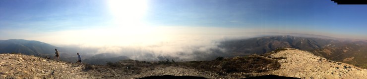
We did a sunset hike, but it’s a gorgeous view any time of day. There’s a false peak about halfway up the path in which my family and I thought we had reached the top the first time I hiked this trail, but then realized we were only halfway up… Keep on going and enjoying the view on both sides as you walk along the ridge.
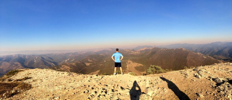
Eventually you’ll be climbing switchbacks again. When you get to the real peak, you’ll be greeted by a sign signaling your 1,400 foot accomplishment and giving you the choice to turn either left or right to reach the 360 degree views of the ocean and the surrounding Central Coast.
I think that turning left is faster to get to the wind blown picnic table at the top, but my parents swear that going to the right is faster, and Conner chose to climb straight up the face of the rocks.
No matter how hot the weather may be at the start of the climb, it’s bound to be windy and chilly at the top so I suggest packing a sweatshirt. As always also make sure that you have water to avoid dehydration and put on sunblock to protect your skin as well as sunglasses to protect your eyes as this hike has no shade! And enjoy the views until the next time you come back to Valencia Peak.


Trailhead address: Pecho Valley Road, Montaña de Oro State Park, Los Osos, CA 93402
Follow Metropolitan Molly updates by subscribing to my newsletter, website and on social media below:
Interested in nominating someone with a stellar story for the COVID Chronicles? Submit them, here.